Tarifa Island Interpretation Center
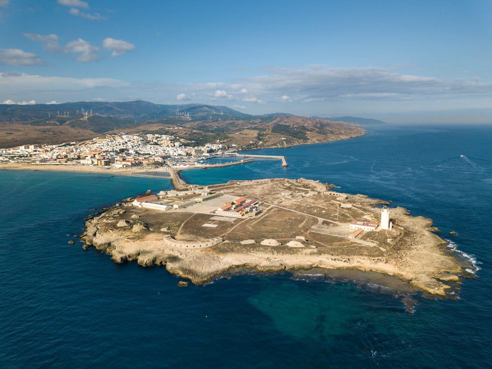
Isla de las Palomas, or Tarifa, is the last rocky outcrop on the European continent, before submerging in the waters of the Strait. Its southernmost point, Punta de Tarifa, is currently occupied by a lighthouse, built in the 19th century using a beacon tower from the 16th century. It was the first lighthouse built in the Strait of Gibraltar.
Due to its location, right at the point where the seas widen, it is probably a magical place for sailors who ventured into its waters. From the passage of the Phoenicians on the island, there remains a series of hypogea or tombs carved into the rock with an entrance through a well, located in the sector closest to the port.
The island, which is larger than the entire historic center, is made up of two types of rock: the lower layer is siliceous sandstone, which is arranged in rocky crests and forms most of the relief in the area. Another type of rock popularly known as oyster beds is superimposed on these layers, formed more recently by ancient beaches and fossilized sea beds and is made up of a large number of mollusk shells. This stone, soft and easy to work with, has traditionally been used in construction (for example, the castle of Guzmán del Bueno). Its extraction has considerably modified the morphology of the island, with the quarry still visible by the sea, through which the rocks were transported by boat, or at the entrance to the island, whose defensive wall is largely the same cut rock.
The island did not host any fortifications until 1588 when the tower that now houses the lighthouse was built. Later in the 19th century, a fortified dock and a complete series of batteries, barracks and an impressive underground powder magazine, excavated in the rock for the defense of Tarifa against the French, were built on its perimeter.
In 1808 the breakwater connecting the island with Tarifa was built. From the moment of its construction, it marks the dividing line between two seas. In the Mediterranean part, the sand that was previously located in La Caleta is now deposited in the cove next to the island, creating what is popularly known as “Playa Chica”, where the people of Tarifa like to swim, sheltered from the winds. Diving baptisms or first immersions are also held there. On the other side of the isthmus, already in the Atlantic, begin the 10 km of Playa de Los Lances and Valdevaqueros, with fine sand.
La Isla de Tarifa tiene las visitas restringidas, y para el acceso es necesario un permiso del Parque Natural del Estrecho.
pnestrecho.dtca.cagpds@juntadeandalucia.es
Tl: 600 161 885
Recientemente y gracias a la colaboración entre administraciones y entidades públicas se ha logrado la recuperación y restauración del edificio anexo al faro de Tarifa -antigua viviendas de los fareros y sus familias- y se ha dotado de una infraestructura museística al edificio. Bajo el lema “La Isla de Tarifa. Testigo de la Historia del Estrecho”, el centro de interpretación divide su temática informativa en cinco bloques:
- El Estrecho de Gibraltar, encrucijada de caminos;
- Los fondos de la Isla, llenos de vida e historia;
- La historia de la Isla;
- La Isla como baluarte defensivo y
- El Faro de la Isla, vigía del Estrecho
Las visitas al Centro de Interpretación de la Isla de Tarifa, siempre con reserva previa, son gestionadas por la oficina municipal de turismo:
centrodeinterpretacionisladetarifa@aytotarifa.com
Tl: 678 904 046

